Four of us set off from Castle Bolton car park, amongst us Dave who had somehow forgotten his helmet and was going to have to take things very easy, especially on the descents. "Fortunately there aren't any tricky descents" we were told, not something I really like to hear.
Leaving the car park we set off due west along the very obvious track. This passes through several gates and splashes across no less than three small fords (which were in fact almost totally dry) before passing though one final gate and becoming a more grassy track that heads off across the moor.

We go straight on at Low Gate and take a sharp left before we get to New Pasture. This takes us down a fairly steep grassy hillside that shows up very well on the elevation profile graph of my flashy new Garmin Edge 500

After 200 yards of pretty steep hillside we arrive at the edge of Ponderledge Scar and what would be - if you went straight on - a vertical drop! Amazing stuff this technology. You have to hook right and come back across diagonally to get down it, but what followed was still full-on steep, though being entirely on grass it wasn't too dangerous or tricky - unless you have no helmet!

A few hundred yards on from the base of Ponderledge Scar we made our first mistake of the day. We should have hung left to stay with the bridleway but stayed straight ahead instead on what was a pretty obvious track. This took us to the wrong side of West End Farm whereupon we were accosted by the farmer who asked us "had we not seen the signs" (we hadn't). In the end he was OK, probably because we're such reasonable people - if we'd have been bolshy we'd have no doubt gotten his goat up (farmer - goat... I should be on the stage). So we cut 100 yards or so left across his farmyard to get back on track - if you're following this route, don't make the same mistake, and if you do, don't get bolshy!
So out of the farm and onto the road at Carperby, just in time to see the Heritage Bus passing through.

A right onto the road followed by a couple of left turns have us on Low Lane which eventually we leave for a track that cuts under the old dismantled railway. There's what is quite obviously an old railway bridge taking the track bed over us a little way down the trail.

The section of track from here on is pretty good, once you get through a few more gates. It becomes quite narrow and "singletrack-y", though it's penned in between a wall and a fence and has a load of twists in it around which may lurk horses or walkers, so we can't open the throttle too much.
Half way along we make a slight detour of exploration, taking a look at a bridleway that leads down to the river (Ure) to a crossing via stepping stones. One of those "something for another day" options that we suss out from time to time. It's not very promising as the bridleway actually doubles as a stream, with plenty of inopportune rocks and low branches thrown in for good measure. We abandon the exploration and get back on track.

Bridleway or stream?
Our nice narrow green lane eventually ends at Low Thoresby and we continue on through Low Bolton and on to Redmire. We turn left up through the village and keep to the main road up and right to begin climbing the lung-busting hill up to the top of Preston Scar. This gains us 500 feet in just over a mile and we're happy to rest in the huge Tank Turning Area at the top for Go Bars and Brazilian Mix.

A slight downhill then, as we continue along the road, but it's short-lived as we turn off to the left onto the track up to Cranehow Bottom and beyond. This is a long, long drag uphill, but thankfully not too steep and not too loose.

At Cranehow Bottom we (I say "we", but I mean "Tony") make our second mistake of the day. "We" decide to try out the track that goes over to The Height Of Brownseat. It's one of those tracks that he's never done before and always wanted to. Well, after a mile or so of heather-bashing with no visible track in sight it ends up in the corner of a moor between two walls. Beyond each wall is yet more heather and still no sign of a discernible track.

Heather bashing.
There are, however, some quite queer animal traps perched at intervals along the wall. Smallish arched cages with an entrance at one end and a spring trap - like a mousetrap but bigger and stronger - in the middle. I set one off with a twig to see what it was like and it disintegrated the twig. Really evil.
We tracked along the wall for a while until it came close to the road, lobbed our bikes and ourselves over it and got ourselves back on track. For Tony & Dave that meant a left on the road then right at the next track along to Dent's House. For me and Sam it was the longer trip, right on the road, down to Ridley Hush then turn left onto the track up to The Heights Of Greets. Second time I've done this climb in 3 weeks and it doesn't get any easier. Drier than last time but still by no means dry, it's an energy-sapping drag up the moss, grass and water covered hillside.

Thankfully it's all downhill after this (well, almost). A full speed pelt down to Dent's House, down that weird track I described last time that seems to somehow defeat your suspension and give you loads of kickback. By the time we got to the end of it I had vibration white finger and cramp in my thighs.
A slight climb now to the top of Black Hill and then it's full speed ahead. Plumetting down the grassy track from the summit for what must be one of the fastest off-road descents around, a few muddy bomb-holes and a large group of walkers being the only cause of consternation as we descended all the way back to Castle Bolton.
We didn't much fancy the tea room at Castle Bolton so it was off to Leyburn and The Posthorn for afters. Friendly service as always, scrambled eggs on toast, chunky scones fresh from the oven and a huge pot of tea. Lovely.
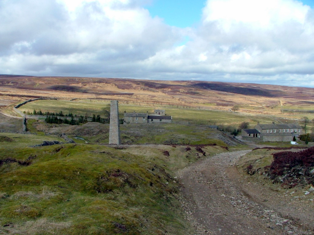
Castle Bolton - Carperby - Redmire
16.7 miles, 2100' of ascent in 3hrs 22mins, of which roughly 1 hour was spent stood still, either eating, being chastised by farmers or trying to find a way out of dead-end tracks.