I don't usually write up the Wednesday rides. They're short, 10 to 12 miles, designed to last just a couple of hours and not be too knackering. They also tended to be round the same 2 or 3 circuits every week. This year has been different, we've done a fair few routes, most of which have been very good, but last night's was the best of the lot. It was more like a weekend ride, but in miniature. Still only 12 miles and with not too much climbing, it crossed some great moorland and took in a number of fantastic singletracks.
Starting from Kildale we headed along the road back towards Great Ayton for a short way before turning off left to head up the tarmac climb up onto Warren Moor. At the top we followed the road a bit further before turning off left onto a bridleway down to Baysdale Abbey, the first time any of us have ridden this way. Vague rumours of "isn't this where Craig went over the bars" had us taking it easy, just in case, but there's no need to worry. The track cuts a fairly narrow path through the heather as it drops a hundred and odd metres, interesting & challenging but not too difficult. Eventually we hit the road for the final stretch down to the farm buildings.
Right here, through a gate and up an indistinct grassy track up the hillside (a real energy sapper) that eventually vanishes into the woods. At this point it's too slippery to ride, the thin coating of soft mud giving no traction whatsoever. The first of a fair few GOAPs of the night.
Emerging from the wood we follow the track across Middle Head and on to Armouth Wath where a fast descent down a stony track takes us through a ford before tackling the steep climb back up the other side to the highest point of our route on Baysdale Moor.
We press on over Baysdale Moor, past Great Hograh Head, eventually bearing right to drop down and cross Great Hograh Beck. Ahead of us now is Skinner Howe Cross Road, one of the best moorland crossings there is. Climbing gently at first (with a little bit of GOAP) it gives way to a gentle descent along a very technical, boulder-strewn singletrack. You can make this more technical by sticking to the proper route and not taking any of the alternative paths that are beginning to be carved out alongside the original. After almost 2km of bliss we hit the road and turn left down to Hob Hole.
A short, sharp climb up the other side then we turn off left back onto bridleway once more. As we ride along the track in the drizzle we see the strange sight of what looks like smoke but is actually steam rising up the hillside ahead of us, the drizzle evaporating from the retained warmth of the woods on the hillside.
At the three-way junction ahead we turn right for the final bit of GOAP of the day, a slippery push to the top of the hill. A brief crossing on level ground takes us to the other side of the hill and a very difficult rut and rock littered descent down the other side. Only Sam manages to clean it, the rest of us taking a fair few dabs and one or two multi-bike pile-ups.
Almost home now. A slow hard slog up another grassy slope with a herd of frisky cows and a brooding bull for company brings us out at Warren Farm and onto the road back down to Kildale. Fast and furious and just a little loose (and in the current weather difficult to see in its canopy of tree cover) it's a speedy descent back to the start in Kildale village.
A brilliant ride, three great singletrack descents, a couple of tough climbs and some great moorland scenery.
Kildale - Baysdale Abbey - Great Hograh - Hob Hole
12.5 miles, 2066' climb in 2 1/2 hours.

Wednesday, 10 June 2009
Sunday, 7 June 2009
Square Corner - Scugdale - Bilsdale
Three of us showed up for this, what turned out to be our longest and highest ride for quite some time - 27 miles with 3500ft of climbing. The weather had promised to be rubbish, cold & wet, but it turned out a lot better than that, though I'm not sure we saw any sun. As a consequence I was a bit overdressed for the ride in the full waterproof rig, which led to some overheating on some of those serious climbs!
The route is too long and too devoid of major incidents or pitfalls to describe in great detail.
Briefly then:
We left Square Corner and headed north on the tarmac, leaving it to the right just past Chequers to take the track towards Sheepwash, turning left through the woods to cross Cod Beck Reservoir. Out the other side, left onto the road towards Osmotherley then sharp right up towards the transmitter station on the hill. Back down to the road at Sheepwash via the Cleveland Way (sticking to the bridleway), then left down the road a short way before ducking right into the woods.
Through the woods, going down the stepped descent by the scenic viewpoint, right at the bottom and along the field/wood edge (following The Cleveland Way once again) before turning left and descending across a field (we'd have been better going straight ahead, but didn't see that bit of track) to emerge once more onto a road. Right here to head towards Harfa Bank Farm, left at the junction of tracks at the end to go past Harfa House, following the farm track back out to the road.
Right here on the road to Raikes Farm and on to Scugdale Hall, passing beyond there on a deteriorating track and following the sign saying "Cycles" off to the left at the end and up a difficult ascent. It was made easier by the dry weather, it would have been totally impossible if the usual mud had been around. We got to the top with a few "dabs", mostly avoidable errors, and then turned right along Barker's Ridge. We followed that bridleway for a few km, bearing round to the right and passing Osmotherley Stones before coming to a T-junction of tracks.
Here we turned left and headed towards Head House where the sight of a downhill got the better of us (we should have stayed level) and took us well of route (and onto footpath). Realising our mistake we climbed back up the hill to Head House and got back on the bridleway. This was a quite gentle, but still tough, climb up to Cock Howe (not the only good descent that we cycled up on this route) where we turned right onto the track that would take us to Bilsdale transmitter, the first time I've been right up to this landmark that's visible from the whole of this section of the moors.
A sharp right from there takes us back down to Low Thwaites, a speedy descent down a good stone doubletrack, turning slight right just past there to pass Round Hill and Sunley Slack before emerging on a road once again.
Left onto the road all the way into Hawnby, turning right at the T-junction in the village and heading out towards Church Bridge. Just after the bridge we turned left onto a piece of bridleway that would take us round Coomb Hill. This is a lovely, and little used, section of bridleway but would be best enjoyed as a downhill! The bridleway ends by diving left to take an indistinct path across a field to rejoin a track/road. This would be really hard to spot coming in the other direction, without prior knowledge - one reason why the track is little used, perhaps.
Right on the road and follow it round past Arden Hall where it rejoins the road proper, though this road is an "unsuitables", the steep, steep climb up past the quarries that eventually emerges on the Drove Road after 3km.
Right onto the Drove Road and we're on the home leg, following it (and The Cleveland Way once again) back towards the top of Black Hambleton and "The Mad Mile".
The walkers at the top of the mad mile add a moment of nervousness - hoping that I won't come a cropper on the rocky steps right in front of them. No problems though (for now), and it's off down the steep track back towards Square Corner, honing my technique to suck up the drainage humps, getting some big air on a few of them.
A mistimed glance back leads to a moment of panic - while looking back, and doing about 35k, I hit a lump. The initial impact throws me forward a bit, then the rear wheel hits and unseats my already off-balance body. Feet come out of the pedals, arse comes well off the seat and the handlebars are my only point of contact with the bike. I don't even have time to crap myself before it all comes back together and I land squarely (and gently) on the saddle and continue as though nothing had happened. Feet back in the pedals and full attention from now on, that would have hurt big-style if I hadn't been so lucky!
More mirth at the end - arriving at the car park mine & Sam's bikes decide to try and mate, throwing us all into a pile on the grass. Luckily not too many walkers were around to witness this amateurish bit of riding skill!!
It had been a ride full of death and carnage. On the route I'd spotted a dead Jay, a dead hawk, 4 dead (Grouse?) chicks, 1 dead sheep and 400 dead rabbits. I was lucky not to have joined them.
No really suitable cafe here, so it's straight back off home for a hot bath to ease the aching limbs.
Square Corner - Scugdale - Bilsdale - Arden Hall
27 miles and 3500' of climb in just 4 1/2 hours was pretty good going and my legs know all about it!
Sunday, 5 April 2009
Tired Legs
This was quite an epic route. 21 miles and 3500 feet of climbing was our toughest combination of the year so far, and to make things even more challenging the toughest of the climbs wasn't on tarmac this week.
Seven of us turned out this week, with a couple of welcome returns in the shape of Rick and Lawrie, neither of whom I've seen for almost a year.
We set off from Reeth village green almost dead on time, heading south east out of the village on the road to Low Fremington. We turn left after just under 1k and climb up to High Fremington on tarmac before taking a left onto the bridleway that tracks along the side of the hill. The views down over the river and Reeth beyond were fabulous.

The track starts off wide and grassy, and isn't too much of a challenge, though every now and then there's a slippy/rocky change of gradient which can prove difficult. Eventually the track narrows and becomes more rocky and rutted, a very fun bit of singletrack, albeit on the level. After just over 3k, as the track gets very close to the river, we have our first bit of mis-navigation when we get carried away by the clearness of the track and miss a turn off. We only go a hundred meters or so before realising and soon get back on track, climbing slightly before following the contours once more. There's quite a ditch to the left of the track for a way here, and obstacles on the trail try their best to divert you into it. No mishaps this time, though the same wasn't true last time we ventured out this way.
Our first and only real foray with the dreaded mud came just before Hegg's House, a swampy section that proved unrideable in parts. Once past there it was plain sailing again, on a particularly picturesque stretch that drops right down to the river before cutting diagonally across a couple of fields to come out by some farm buildings. Keeping left we drop back down to the river and follow the track along to Langthwaite.

Here we turn right, up through the village on a tarmac climb on a road that eventually peters out to become bridleway on its way to Booze. Once again the views, this time down over Arkle Town, are simply stunning and it's time for more photos. Pressing on we get lost again at Booze, and end up following a trail on the ground that isn't the actual right of way. We make a big loop around some fields, finding our way through a couple of gates to eventually get ourselves back on track. For a few meters at least, then we're back off exercising our "right to roam" at some poor farmers expense, climbing all the while.

A couple of hundred m of this eventually has us back on the legal route as we pass over Peat Moor Green and start to get amongst the mine workings that litter this area. Staying straight on, we follow the contour lines around the hillside on a very well surfaced track before dropping down left, a speedy descent onto the tarmac of Stang Lane.
Going left down Stang Lane we're once again off route. Carried away by the need for speed we pass our turning, and even when doubling back we still pick up the wrong trail. More illegal "right to roam" across virgin moorland (luckily we don't meet any Parish Councillors) and we eventually end up on the right track again, somewhere around Windegg Ings. Keeping right just beyond there we come across the bizarre prospect of having to cycle through someone's garden. A quick check reveals it to be the right route, confirmed by the National Park signage on the gates, and through we go, taking care to avoid the kid's toys and the daffodils.

Once through the garden we drop across the contour lines for a speedy descent down the rabbit killing fields that is Scarhouse Lane - never have I seen so many dead bunnies in such a short stretch of track. On crossing the bridge we're off on the wrong track once again - who'd believe two of us have portable GPS units on our bars? If only we knew how to use them! Backtracking once more, we eventually hit the road from Langthwaite.
Turning right up the hill we are passed at regular intervals by a procession of fabulous vintage open-top cars, and today's the day to be out in them! 1k on up the road and we turn off left onto the start of one of the most torturous and arduous climbs I've ever done.
It's not too bad at first as we pick our way along the indistinct track, doing a good job of it for once, but then the incline just gets steeper and steeper. In the lower reaches it's soft grassy track that's like riding with your brakes on. On one occasion I do actually pick my bike up and spin the wheels cos I'm convinced something mechanical is slowing me down. No, it's just the soft spongy grass and my tiring legs. On and on it goes before reaching a sharp switchback to double back on itself. On and on, less grassy now until we reach another switchback. I round it to see Rob & Tim pushing - never a good sign, this is obviously unrideable stuff of the highest magnitude. Large, rough-hewn stones form a surface that would be no fun to come down, and it's certainly no fun to go up. We walk it and are thankful when we reach the top - by the time we reach Great Pinseat we've climbed 250m, all of it an energy-sapping slog.

That's the majority of the day's climbing over though, and we track across the moor, vaguely down hill, though being boggy and mossy it's not enough to give any rest, until we reach Little Punchard Head. Turning left there's a little more speed to be had on the track to Doctor Gill. The excitement of finally seeing a bit of downhill and some rocks is too much for Lawrie and decides to take a real close look - head-first. We pause at the track crossroads by a spoil heap that crops up on many of our routes and which we've dubbed "Rob's Mound". Rob indulges us once again with his party-piece, a front wheelie descent of the mound, before we bomb off down the hill for the 50kph drop to Level House Bridge.

I did say it was only the majority of climbing that we'd done, so we're off uphill once again, turning left at the bridge to climb up towards Surrender Ground, at which point we find we're being pursued by a group from Durham University! We exchange pleasantries at the top before setting off once again for a bit of downhill fun. The descent from Surrender Ground to the road is almost 3k of fast and furious fun down loose-stoned track that requires no braking. Well, except for the bit where speed got the better of me and I left the track completely to jet off across uncharted moorland.

At the road we turn left, crossing the ford and heading up hill (really, this IS the final climb) to leave the road once more (on the right) for the track to Healaugh. It had been our intention to take a different route down to the one we usually do, but we passed the turn off at a speed that was way too fast to be looking at GPS readouts, and before we knew it we were on the tarmac track that we always take. Highest speed of the day down this bit, 55k, before ending with the trudge back to Reeth. I always wish there was some kind of bike-transfer from Healaugh to Reeth as I hate that bit of road. The legs are always dead by the time I get there, and with no more excitement to come there's little incentive to press on.
Afters in Reeth is at the "old usual" tea room (is it the Copper Kettle?). After a winter closure and a refit it's open once again, so no cockney crumpet for me today. Scones, cakes and all-day breakfasts are wolfed down and we meet the Durham Uni lads & lasses again!
Reeth - Great Pinseat - Little Punchard:
21.5 miles, 3500' of ascent in 4 hours 53, 1 1/2 of which was spent standing still. What DO we do for all that time? Thankfully only one thorn puncture this week, Stewart with a repair time of 9 minutes, which was pretty good.
A cracking ride - great scenery, good technical sections, tough climbs and white-knuckle descents, what more could you ask?
Farewell to Young Rob and good luck up in Scotland. No one for me to pick up new skills from now, unless I want to master the art of falling off sideways.
Sunday, 29 March 2009
Thorn In My Side
Four of us gathered on this lovely sunny spring morning for a ride that would take in a fair few bits of untried trails on a route round "Heartbeat Country".
We set off slightly later than planned, leaving the car park and turning left to cross the level crossing. Just beyond that we take a right between some buildings, down an "unsuitables" towards the river. Here there are three ford crossings in quick succession, two of them across the deep and fast flowing Murk Esk. No problem though, they're proper fords with a concrete base only a few inches below the water, crossing should be a doddle. Well, no. Whether it's slime or ice or whatever, there's no grip at all and within a few feet both front and back wheel are skating off in opposite directions, dumping me on my backside into the icy cold water. Thank God for Endura waterproofs! Not for the last time today though I was wishing I'd gone for Sealskinz socks too as I set off again with cold wet feet.

Forewarned is forearmed and the next two crossings were uneventful and we began the steep tarmac climb up past Dale End Farm and Morton Close to eventually reach the road. Sharp left here and just over 1k of roadwork brings us to a permissive bridleway off to our right. The key word here will be "bridleway". About half way along this track we run into Mr Angry, claiming to be "on the parish council" who blocks the way and insists we shouldn't be riding on this track as "it's bridleway". He's lucky that we're reasonable people and responsible riders; standing in the way of a fast moving mountain bike can be a dangerous pastime. We leave him behind shaking his fist, and spend the rest of the ride moaning about him.

After just over 2k we arrive at the road once more at Goathland. We turn right onto the road, cross the river and the railway (with a particularly nice view of the station) and climb up into the village where I have to stop by the "Aidesnfield Garage" (tourist trap shop) to repair the first puncture of the day. If only we knew then how this day would turn out... Repair time, approx 11 minutes.
Off once more, following the road through the village, keeping left at the end of the main street and eventually passing the Mallyan Spout Hotel, just beyond which we take a bridleway off to the left. We stay low, parallel to the road, eventually staying TOO low and following the wrong trail. No harm done, other than a couple of hundred m of illegal riding, and we exit at the road just a little way short of where we should have. It's been a good stretch of moorland trail, nice rocky, technical singletrack.

Along the road a short way before turning sharp right at Gill View to drop down another bridleway towards yet another ford, though this one is totally dry! A nice tough climb after this, up a challenging bit of singletrack that's cut in a channel up the hillside. It gains us 65m in just over 1/2k before levelling out by Hazel Head Farm.

A nice bit of farm track now, past Hollin House Farm and on to Julian Park where we turn left. 800m further on and we're turning off road once more at Randy Rigg! A little drop down takes us into an area of grassy wetlands that is tricky to ride, in fact impossible in places. Once or twice we almost lose our bikes completely in water that is up past our wheels and my just-about-dry feet are wet and cold once more.

Having got through that we now have a tough climb up, tough because of the lack of traction rather than out & out steepness. At the top of the climb we come out onto open moor and take a track that is barely visible before pausing at a gate to look down at where we're meant to be going next.

There's barely anything visible at all as we pick our way down the steep moorside and we find ourselves on the wrong side of a wall. A bit of fence and ditch hopping ensues as we try to get back on track, but we've no idea where the real right-of-way is. We press on, generally in the right direction but never quite on the right track until eventually we pick up the route again, a fine bit of barely-used singletrack that climbs up and over In Moor to eventually come out at the road. It's been a difficult job of navigating but worth it.
Left onto the road for a short stretch before turning right once again onto more indistinct track. It's hard to navigate at times, but it's a nice downhill section, nothing exciting or challenging, just gentle moorland, but a chance to rest the legs a bit. Passing Swang Farm and Hall Grange Farm we eventually hit a steep and very straight downhill section where the brakes come off and the speed goes up, before coming out on the road.
Left here for a bit, as far as The Delves where a right turn has us back offroad once again, ducking into the forest. At the start it's a steep uphill over rocks that are slippery when wet (are they ever dry here?) and we have a few goes at trying to clean it before giving up and hiking.

After hitting level ground again we have to stop to fix a broken chain, once again that great invention the SRAM Power Link coming to the rescue (note to self, order another few, that's 2 we've used in the last few months).
The track through the woods is interesting and exciting. Undulating but generally downhill, it is paved the whole length with great stone slabs and in some parts this path is quite high compared to the ground around it. It's like riding a stone boardwalk, and with the river cutting a steep cliff just to your right. At one point I get a little too much excitement, I lose my line and plunge off the path, a healthy sized drop off with the river cliff just beyond, but I hold it and get back on line at the next convenient point.
The stone path levels out next to the river, where Rob decides to plunge his bike in to get rid of some of the excess weight it's carrying in the form of mud - oh yes, mud is back on the menu on this ride. Pulling the bike back out of the water we can hear a hissing noise that can only be air escaping from a puncture. Were there thorns in that wood? It's a beautiful spot to get a puncture.

A little further on and we emerge from the woods by the magnificent arched packhorse bridge at Glaisdale. Apparently there WERE thorns in the wood because I find I've got a puncture too, my second of the ride. I change the inner while Rob puts more air in his tire - repair time 14 minutes, I'm not getting any faster.
Off we go again, right at the road and up the precipitously steep Limber Bank. This looks and feels like the steepest section of bank I've ever done and the front end wants to rear up with every pedal stroke. Eventually the gradient lessens to something comparatively flat, though it's still an uphill slog to Egton. Here we make our biggest mistake.
A quick plunge down the bank brings us to a bridleway off to the left by the school. This track will take us downhill to the railway and the path back to Grosmont . Unfortunately it's littered with freshly flailed thorns, some a couple of inches long. As my bike seems to have become a thorn magnet today it's not long before I'm riding on a flat again. I have to borrow my second tube of the day to make the repair - time taken 7 minutes. Fastest change so far, no doubt down to the realisation that my pump is rubbish and tires inflate much faster with Tony's.
From here I'm not even going to ride, there's just too many thorns and I don't want a fourth puncture, that would be too embarrassing. It doesn't work out though, and even pushing I manage to get a bad boy right through my front sidewall. I'm in good company. When we catch up Rob & Tim we find they have 3 punctures between the two of them. With no spare tubes, and no great enthusiasm for trying to repair the holes anyway, we trudge our way the last 2k back to the start point. Tony gleefully and gloatingly cycles most of the way before succumbing to his own slow puncture a couple of hundred meters from the end.
Four riders and 9 punctures, that has to be a record!

The tea shop at Grosmont Station, the only offering at this time of year, was a disappointment. No cooked food at this time of day (and anyway, they only do full English till 11:30), no scones, a limited selection of cakes and soup that looked and tasted like it came from a packet. At least the coffee was nice.
Grosmont - Goathland - Glaisdale
16.5 miles, 2400' of ascent in 4 hours 45, 1 hour 50 of which was spent fixing punctures and wondering where the trails had vanished to, and half an hour's slow trudge back dragging bikes beset by punctures.
We set off slightly later than planned, leaving the car park and turning left to cross the level crossing. Just beyond that we take a right between some buildings, down an "unsuitables" towards the river. Here there are three ford crossings in quick succession, two of them across the deep and fast flowing Murk Esk. No problem though, they're proper fords with a concrete base only a few inches below the water, crossing should be a doddle. Well, no. Whether it's slime or ice or whatever, there's no grip at all and within a few feet both front and back wheel are skating off in opposite directions, dumping me on my backside into the icy cold water. Thank God for Endura waterproofs! Not for the last time today though I was wishing I'd gone for Sealskinz socks too as I set off again with cold wet feet.

Forewarned is forearmed and the next two crossings were uneventful and we began the steep tarmac climb up past Dale End Farm and Morton Close to eventually reach the road. Sharp left here and just over 1k of roadwork brings us to a permissive bridleway off to our right. The key word here will be "bridleway". About half way along this track we run into Mr Angry, claiming to be "on the parish council" who blocks the way and insists we shouldn't be riding on this track as "it's bridleway". He's lucky that we're reasonable people and responsible riders; standing in the way of a fast moving mountain bike can be a dangerous pastime. We leave him behind shaking his fist, and spend the rest of the ride moaning about him.

It doesn't say "No Bikes!"
After just over 2k we arrive at the road once more at Goathland. We turn right onto the road, cross the river and the railway (with a particularly nice view of the station) and climb up into the village where I have to stop by the "Aidesnfield Garage" (tourist trap shop) to repair the first puncture of the day. If only we knew then how this day would turn out... Repair time, approx 11 minutes.
Off once more, following the road through the village, keeping left at the end of the main street and eventually passing the Mallyan Spout Hotel, just beyond which we take a bridleway off to the left. We stay low, parallel to the road, eventually staying TOO low and following the wrong trail. No harm done, other than a couple of hundred m of illegal riding, and we exit at the road just a little way short of where we should have. It's been a good stretch of moorland trail, nice rocky, technical singletrack.

Along the road a short way before turning sharp right at Gill View to drop down another bridleway towards yet another ford, though this one is totally dry! A nice tough climb after this, up a challenging bit of singletrack that's cut in a channel up the hillside. It gains us 65m in just over 1/2k before levelling out by Hazel Head Farm.

A nice bit of farm track now, past Hollin House Farm and on to Julian Park where we turn left. 800m further on and we're turning off road once more at Randy Rigg! A little drop down takes us into an area of grassy wetlands that is tricky to ride, in fact impossible in places. Once or twice we almost lose our bikes completely in water that is up past our wheels and my just-about-dry feet are wet and cold once more.

Having got through that we now have a tough climb up, tough because of the lack of traction rather than out & out steepness. At the top of the climb we come out onto open moor and take a track that is barely visible before pausing at a gate to look down at where we're meant to be going next.

There's barely anything visible at all as we pick our way down the steep moorside and we find ourselves on the wrong side of a wall. A bit of fence and ditch hopping ensues as we try to get back on track, but we've no idea where the real right-of-way is. We press on, generally in the right direction but never quite on the right track until eventually we pick up the route again, a fine bit of barely-used singletrack that climbs up and over In Moor to eventually come out at the road. It's been a difficult job of navigating but worth it.
Left onto the road for a short stretch before turning right once again onto more indistinct track. It's hard to navigate at times, but it's a nice downhill section, nothing exciting or challenging, just gentle moorland, but a chance to rest the legs a bit. Passing Swang Farm and Hall Grange Farm we eventually hit a steep and very straight downhill section where the brakes come off and the speed goes up, before coming out on the road.
Left here for a bit, as far as The Delves where a right turn has us back offroad once again, ducking into the forest. At the start it's a steep uphill over rocks that are slippery when wet (are they ever dry here?) and we have a few goes at trying to clean it before giving up and hiking.

After hitting level ground again we have to stop to fix a broken chain, once again that great invention the SRAM Power Link coming to the rescue (note to self, order another few, that's 2 we've used in the last few months).
The track through the woods is interesting and exciting. Undulating but generally downhill, it is paved the whole length with great stone slabs and in some parts this path is quite high compared to the ground around it. It's like riding a stone boardwalk, and with the river cutting a steep cliff just to your right. At one point I get a little too much excitement, I lose my line and plunge off the path, a healthy sized drop off with the river cliff just beyond, but I hold it and get back on line at the next convenient point.
The stone path levels out next to the river, where Rob decides to plunge his bike in to get rid of some of the excess weight it's carrying in the form of mud - oh yes, mud is back on the menu on this ride. Pulling the bike back out of the water we can hear a hissing noise that can only be air escaping from a puncture. Were there thorns in that wood? It's a beautiful spot to get a puncture.

A little further on and we emerge from the woods by the magnificent arched packhorse bridge at Glaisdale. Apparently there WERE thorns in the wood because I find I've got a puncture too, my second of the ride. I change the inner while Rob puts more air in his tire - repair time 14 minutes, I'm not getting any faster.
Off we go again, right at the road and up the precipitously steep Limber Bank. This looks and feels like the steepest section of bank I've ever done and the front end wants to rear up with every pedal stroke. Eventually the gradient lessens to something comparatively flat, though it's still an uphill slog to Egton. Here we make our biggest mistake.
A quick plunge down the bank brings us to a bridleway off to the left by the school. This track will take us downhill to the railway and the path back to Grosmont . Unfortunately it's littered with freshly flailed thorns, some a couple of inches long. As my bike seems to have become a thorn magnet today it's not long before I'm riding on a flat again. I have to borrow my second tube of the day to make the repair - time taken 7 minutes. Fastest change so far, no doubt down to the realisation that my pump is rubbish and tires inflate much faster with Tony's.
From here I'm not even going to ride, there's just too many thorns and I don't want a fourth puncture, that would be too embarrassing. It doesn't work out though, and even pushing I manage to get a bad boy right through my front sidewall. I'm in good company. When we catch up Rob & Tim we find they have 3 punctures between the two of them. With no spare tubes, and no great enthusiasm for trying to repair the holes anyway, we trudge our way the last 2k back to the start point. Tony gleefully and gloatingly cycles most of the way before succumbing to his own slow puncture a couple of hundred meters from the end.
Four riders and 9 punctures, that has to be a record!

How Much For Bikes?
The tea shop at Grosmont Station, the only offering at this time of year, was a disappointment. No cooked food at this time of day (and anyway, they only do full English till 11:30), no scones, a limited selection of cakes and soup that looked and tasted like it came from a packet. At least the coffee was nice.
Grosmont - Goathland - Glaisdale
16.5 miles, 2400' of ascent in 4 hours 45, 1 hour 50 of which was spent fixing punctures and wondering where the trails had vanished to, and half an hour's slow trudge back dragging bikes beset by punctures.
Sunday, 15 March 2009
Bainbridge: Yorkshire Relish
The more often I go riding in North Yorkshire, the more I come to think that it truly is "God's own country". The ride today linked two of the most beautiful parts of the Yorkshire Dales , Wensleydale and Wharfedale, in sunny conditions that bettered much of last year's summer. The views throughout the route were simply stunning, making even the long uphill drags an absolute pleasure.
A pity on this fine, sunny day that there were only three of us, but three is better than none. We set off on time from the village green at Bainbridge, heading back along the A684 for a couple of hundred meters before turning off right towards Stalling Busk, keeping right at the next fork in the road, 1/2k further on.

This gentle road climb gives great views of Semer Water off to the right and the bizarre spectacle of dozens of dead moles strung up on the fences to our left. A warning to other would-be moles, or the mole-catcher's way of collecting his per-head bounty, who knows?

After about 4k the road reaches a T-junction right above Semer Water where we turn left after stopping for more great photo opportunities and a quick word with the friendly farmer who's doing up his dry stone walls. 800m further on and we finally turn off road, taking the track off to the left by the Stalling Busk sign for over 7k of byway.
The climb is prolonged but not too steep as the track cuts its way diagonally across the contours, but it's way too hot for the gear we've set out in. A quick stop part way along the track to shed some outer layers and we're off again, following the track as it arcs left around the hill above Cragdale before eventually joining up with the track from Carpley Green. 1 1/2k further on and we're finally at the summit at Stake Moss and only have downhill to look forward to, for the near future at least.

The track from Stake Moss (Gilbert Lane) falls away steeply, but is too loose, rocky and rutted for extreme speed. Some rock drop-offs add to the fun and 150m is lost in 1.5k before we hit the road. Right turn onto the road and time for a few seconds of extreme speed down the steep, tarmac hill, taking care not to get too carried away and shoot off past our turning point. Just before Cray High Bridge we turn left, off-road once more, passing through a particularly attractive piece of countryside that is punctuated by streams fed from waterfalls off to our left. Three ford crossings in a couple of hundred meters provide our first and only bit of entertainment of the falling-off kind. While Tony waits to photograph him splashing through a ford, Sam manages to fall off into it. I do hate it when Tony waits with the camera, I always expect to fall of right in front of it. I'm just glad it was Sam this time, but unforgivably Tony actually misses the shot!

Off we head once more for the very gentle climb along Buckden Rake until we reach the top of the track that leads down into Buckden village. This would give us the chance of some breakneck speed (and maybe some broken necks!) if it weren't for all the walkers littering the trail. We pass them carefully, using only as much speed as is appropriate before releasing the brakes for the final fling down to the gate where the trail is less restricting.

Enough of the off-road fun for now, now we've got a full 14k of roadwork. Anywhere else that might seem a bit of a drag, but not here and not in this weather. Crossing the road and taking Dubbs Lane out of Buckden we join up with the River Wharfe at Hubberholme, us on one side of the river, The Dale's Way Path on the other. Bikers and walkers a safe distance apart!
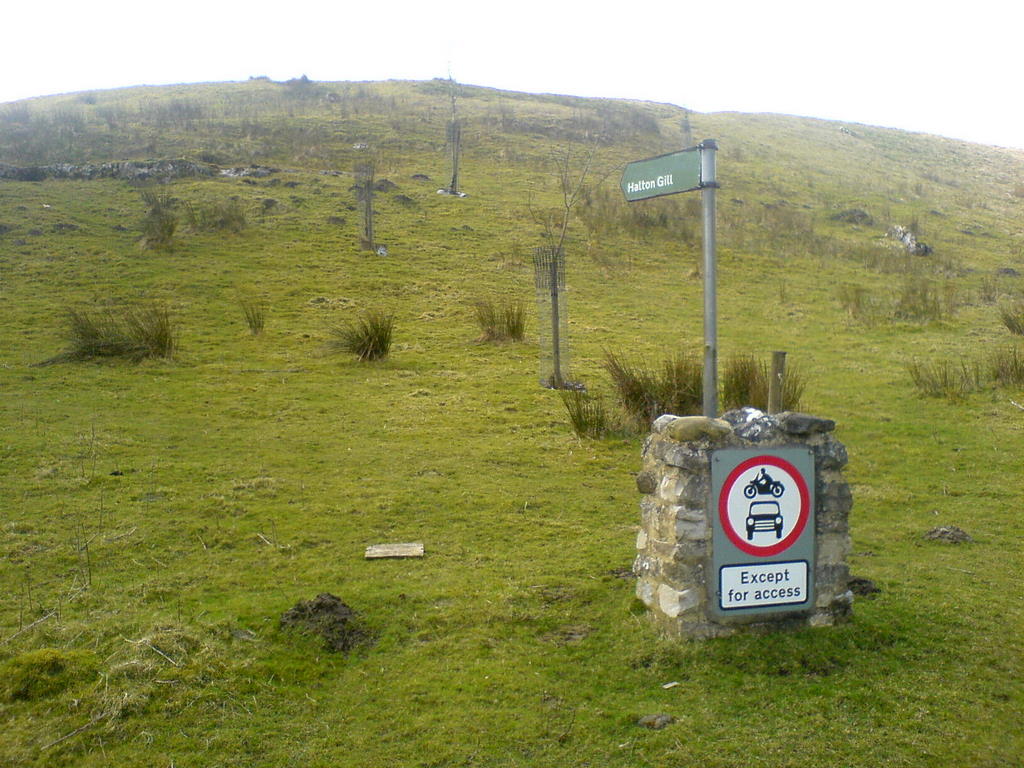
Close to Yockenthwaite we spot a track off to the left, leading up and over the hill to Halton Gill. Something for another day, perhaps.

By now we're following the river very closely, a particularly picturesque stretch where the river scrambles over and around the boulders that litter the river bed - a fine place to stop for a go-bar lunch and to take more photos.

Pressing on we cross the river at Deepdale Bridge, swapping sides once more with The Dale's Way Path. We turn right at the junction a little further on and do the short, sharp climb up into Oughtershaw where a remotely sited Wesleyan Chapel catches my eye, its grandeur a testament to how big the movement used to be out in these parts.
Time for some real climbing now, 240m in about 3k. Thankfully it's tarmac and the weather and the scenery are fine, so it's not even a boring climb. It's not too taxing either, and I even have time to be chatted up by a young motorist with a pretty smile who wants me to tell her the best place for downhilling around here. Well, we're heading for a pretty good one, there'll be amlost 7k of sustained downhill once we get to the top of this!
Eventually we reach the turn off (on the right) for the old Roman Road that leads back into Bainbridge, though cruelly this is after losing over 100ft that we'll have to regain! After a couple of k of climbing and level running we reach the start of the downhill. For the next 5k it's simply a question of how fast dare you go. There's nothing too challenging about the surface, though it's lumpy and bumpy and strewn with loose stones and rocks in places, as well as some ruts and a road-crossing. I peak at 30mph, but feel slightly out of my comfort zone at times, especially on some of the looser, lumpier stuff. Exhilaration gets the better of wisdom at times.

That last 5k seems to have taken no time at all, and in fact it's only been 11 minutes. All that's left is the short downhill road section into Bainbridge, and the chance to add almost another 10mph to the day's top speed. While packing away the bikes we have a chance encounter with Howard, out for a blast on his Kawasaki but assuring us he'd rather have been on his MTB. Yeah, yeah!

Back to Leyburn for afters; the all-day veggie breakfast is good but not quite as good as I remember it, and not as good value as the one at Castleton that's almost £2 cheaper. Still, no 1930's music and no sex-pest grannies, and my take-out treat of Old Peculier Fruit Cake is delicious, so it's not all bad.

Bainbridge - Buckden - Langstrothdale:
24.2 miles in 4 hours 15, 1 hour 15 of which was spent admiring the view, eating bananas and chatting up motorists. This was a fabulous ride, the stunning scenery more than making up for the extended on-road sections.
A pity on this fine, sunny day that there were only three of us, but three is better than none. We set off on time from the village green at Bainbridge, heading back along the A684 for a couple of hundred meters before turning off right towards Stalling Busk, keeping right at the next fork in the road, 1/2k further on.

This gentle road climb gives great views of Semer Water off to the right and the bizarre spectacle of dozens of dead moles strung up on the fences to our left. A warning to other would-be moles, or the mole-catcher's way of collecting his per-head bounty, who knows?

After about 4k the road reaches a T-junction right above Semer Water where we turn left after stopping for more great photo opportunities and a quick word with the friendly farmer who's doing up his dry stone walls. 800m further on and we finally turn off road, taking the track off to the left by the Stalling Busk sign for over 7k of byway.
The climb is prolonged but not too steep as the track cuts its way diagonally across the contours, but it's way too hot for the gear we've set out in. A quick stop part way along the track to shed some outer layers and we're off again, following the track as it arcs left around the hill above Cragdale before eventually joining up with the track from Carpley Green. 1 1/2k further on and we're finally at the summit at Stake Moss and only have downhill to look forward to, for the near future at least.

The track from Stake Moss (Gilbert Lane) falls away steeply, but is too loose, rocky and rutted for extreme speed. Some rock drop-offs add to the fun and 150m is lost in 1.5k before we hit the road. Right turn onto the road and time for a few seconds of extreme speed down the steep, tarmac hill, taking care not to get too carried away and shoot off past our turning point. Just before Cray High Bridge we turn left, off-road once more, passing through a particularly attractive piece of countryside that is punctuated by streams fed from waterfalls off to our left. Three ford crossings in a couple of hundred meters provide our first and only bit of entertainment of the falling-off kind. While Tony waits to photograph him splashing through a ford, Sam manages to fall off into it. I do hate it when Tony waits with the camera, I always expect to fall of right in front of it. I'm just glad it was Sam this time, but unforgivably Tony actually misses the shot!

Off we head once more for the very gentle climb along Buckden Rake until we reach the top of the track that leads down into Buckden village. This would give us the chance of some breakneck speed (and maybe some broken necks!) if it weren't for all the walkers littering the trail. We pass them carefully, using only as much speed as is appropriate before releasing the brakes for the final fling down to the gate where the trail is less restricting.

Enough of the off-road fun for now, now we've got a full 14k of roadwork. Anywhere else that might seem a bit of a drag, but not here and not in this weather. Crossing the road and taking Dubbs Lane out of Buckden we join up with the River Wharfe at Hubberholme, us on one side of the river, The Dale's Way Path on the other. Bikers and walkers a safe distance apart!
Close to Yockenthwaite we spot a track off to the left, leading up and over the hill to Halton Gill. Something for another day, perhaps.
By now we're following the river very closely, a particularly picturesque stretch where the river scrambles over and around the boulders that litter the river bed - a fine place to stop for a go-bar lunch and to take more photos.

Pressing on we cross the river at Deepdale Bridge, swapping sides once more with The Dale's Way Path. We turn right at the junction a little further on and do the short, sharp climb up into Oughtershaw where a remotely sited Wesleyan Chapel catches my eye, its grandeur a testament to how big the movement used to be out in these parts.
Time for some real climbing now, 240m in about 3k. Thankfully it's tarmac and the weather and the scenery are fine, so it's not even a boring climb. It's not too taxing either, and I even have time to be chatted up by a young motorist with a pretty smile who wants me to tell her the best place for downhilling around here. Well, we're heading for a pretty good one, there'll be amlost 7k of sustained downhill once we get to the top of this!
Eventually we reach the turn off (on the right) for the old Roman Road that leads back into Bainbridge, though cruelly this is after losing over 100ft that we'll have to regain! After a couple of k of climbing and level running we reach the start of the downhill. For the next 5k it's simply a question of how fast dare you go. There's nothing too challenging about the surface, though it's lumpy and bumpy and strewn with loose stones and rocks in places, as well as some ruts and a road-crossing. I peak at 30mph, but feel slightly out of my comfort zone at times, especially on some of the looser, lumpier stuff. Exhilaration gets the better of wisdom at times.

That last 5k seems to have taken no time at all, and in fact it's only been 11 minutes. All that's left is the short downhill road section into Bainbridge, and the chance to add almost another 10mph to the day's top speed. While packing away the bikes we have a chance encounter with Howard, out for a blast on his Kawasaki but assuring us he'd rather have been on his MTB. Yeah, yeah!

Back to Leyburn for afters; the all-day veggie breakfast is good but not quite as good as I remember it, and not as good value as the one at Castleton that's almost £2 cheaper. Still, no 1930's music and no sex-pest grannies, and my take-out treat of Old Peculier Fruit Cake is delicious, so it's not all bad.

Bainbridge - Buckden - Langstrothdale:
24.2 miles in 4 hours 15, 1 hour 15 of which was spent admiring the view, eating bananas and chatting up motorists. This was a fabulous ride, the stunning scenery more than making up for the extended on-road sections.
Sunday, 8 March 2009
Rudland Rigg & Bloody Hail!
What is it with Rudland Rigg? It seems that every time I go up there it blows a gale and lashes down with hailstones! Today was another of those days; generally a bright and fine day until we ascended onto Rudland Rigg and what started as light sleet degenerated into stinging hail. At one point it had us sheltering in a grouse butt!
Six of us set off today on our second ride from Low Mills in recent weeks, though this one followed a completely different route to the first. Turning left out of the car park we then took the left fork in the road and then right onto Daleside Road for 4k of road work, a long gentle climb to warm us up for the tougher climbs that must surely lie ahead.
After 4k we turned right onto Lund Road, a broad, fast downhill track. All that gained height lost so soon! Over the river at Lowna Bridge and then the steep little climb up into Gillamoor where we stop for a protracted rest right in the middle of the road junction. It’s a testament to how quiet these moors roads are that we weren’t disturbed by a car once.

Moving on we pass through Fadmoor, doing a left-right at the end of the village to take us towards Green Lane and left onto Caldron Mill Road. So far so good – the roadwork and decent tracks has left us mud free, but surely that can’t last. A right turn down into Mell Bank Wood looks ominous; muddy it is, but the mud isn’t deep and the track stays firm. Taking a diagonal right turn towards Cogg Hole we head for the ford to cross the river, the track taking us through a field that is more mud-lake than arable pasture. Mud up to my wheel centres – this is more like it!

We cross the ford without getting our feet wet - there's a bridge there that's signed "unsuitable for horses". Makes no mention of bikes, so over we go. A tough little climb up out of the woods at the other side is just the intro for over 5km of solid climbing which gains us over 220m. The final couple of k are along the edge of Aldergate Bank, with the wind picking up and doing its best to push us over the edge as we slog our way along the rutted double track. We pass the delightfully named Potato Nab and finally reach the summit at Rollgate Bank.

A bit of fun now, the short, sharp blast down Rollgate Bank. Nothing too challenging, save for the odd muddy rut, but a good chance to get up some speed and rest tired legs. Just as well, because coming up is my "favourite" (the quotes indicate irony) bit of doubletrack, the dolomite paved hell that is Little Roll Gate. It starts off quite fun; deep ruts, puddles and mud holes that you can pick your way around and through with a bit of skill and good judgement, but eventually it deteriorates into an "improved" section of track that is slab after slab of rough laid stone. Not challenging and not fun, just a slog, and an uphill one at that. It ends, thankfully, by the large puddle/small lake formed in the remains of some old quarry workings.

Here the track goes four ways, and we take the right fork. 600m on and the fun begins again. The track drops down the hill to become fast and challenging, most of the challenge coming from the ruts and the slippery mud. More than once I find myself cornering like a speedway rider and on one occasion lose my back end completely, ending up (gently) in a ditch. The fun ends with the realisation that we've taken the wrong track. As Roy Walker might say "it's good, but it's not right". We should have forked left soon after our descent began, but we got carried away by the speed and the fun and followed something that doesn't exist on the map and yet was very real on the ground. No matter, we track to the left alongside a wall, heading for our lunch stop at Stork House a little way in the distance. Time still for a little more amusement at Sam's expense. An ill-judged drop off into a lake of mud sees him pitched head first into it. He manages to keep his head clear, and therefore clean, but that's the only bit of him that is. As far as Sam is concerned, brown is now the new black.

Lunch at Stork House, a quite extensive and by the looks of it once rather magnificent farm complex that is now a sad, fenced-off ruin. We look at the landscape and the map and wonder where we went wrong with our descent, while stuffing our faces with go-bars and bananas.

We head off once more, a steep, leaf covered downhill takes us past Stocking Crags and over Hodge Beck via another handily placed bridge - it's nice to keep our feet dry for once! Too much descending lately, so it's time to climb again, another 5k of climbing to be exact. From Hodge Beck we go on to Shaw Beck, climbing up to the road past the disused quarry. Left at the road and then after 1800m branching offroad once more (to the right) onto the track over Shaw Ridge. By now the wind is blowing hail about and I'm fearing the worst as Rudland Rigg approaches. At the T-junction of tracks we pause for a while to wait for our stragglers, taking shelter in some grouse buts to keep out of the worst of the weather while we mull over what enjoyment can be had from shooting at birds that can barely fly.

Onward once more, (taking the right fork at the T-junction) into the driving hail and towards the junction with the track over Rudland Rigg, where we turn right again at the 4 way crossroads. Another 500m and we're at the start of what must be the finest downhill on the Moors. Taking a track off to the left we start with a bit of heather bashing, an inauspicious start to the pleasures that are to follow, and in fact (according to mytracklog ) we get quite a way off the official route. The track eventually becomes more distinct as it begins to plummet more steeply down the hillside, picking its way between and over rocks, hugging the edge of precipitous drops and plunging through springs and mud holes. It's nice to be able to appreciate it fully - the hail has stopped and we're sheltered from the wind, two things that never happened last time I tried this descent.

The track widens out eventually and the best of the fun is over as we regroup at High Barn. Still a bit more downhill to go though, not so challenging now, which of course means faster. There's still time for one more piece of amusement. Tony has a rush of blood to the head when he thinks he can do his second piece of overtaking in two months, but his passing attempt ends in a spill which results in him being attached to and dragged along by my bike! Luckily the muddy ground was soft enough that no damage was done, but Tony now agress with Sam about brown being the new black.

Finally we're at the road where we turn right for the final few hundred meters back to the start.
This has been a fabulous ride. There must have been four good descents on it, all of them fun in varying degrees, with the best saved till last. It's great to enjoy a downhill experience like that final one and not have to ruin it with another big climb!
Off to Castleton as usual for afters. This time the 1920's music was being appreciated by a group of women who were teenagers when it still in fashion and probably owned it on waxed cylinder. They took a shine to our Muddybums hoodies and engaged in some mild sexual innuendo. It could only happen in Castleton's "time warp" tea rooms.
The veggie & non-veggie all day breakfasts and the scones were as good as ever, and we added a couple of bowls of "real chips" too. Tasty if somewhat greasy, the second bowl was swimming in a pool of grease, enough to lube up all our bikes' drive chains!
Farndale (Low Mill) - Bransdale - Rudland Rigg.
20 miles dead in 4 hours, 1 of which was spent stood still. Plenty of good downhills (one stunner), no unrideable sections and not too much mud. Perfect.
Sunday, 1 March 2009
Boltby, Thorodale & Arden Hall
Five of us today with the return for the first time in a while of Andy and the first time in a longer while of Mark. The weather promised to be “niceish” and started off sunny, deteriorated to a spot of light drizzle before returning to sunny. There having being no significant rain for quite a few days we were hoping to avoid mud. Well I only said “hoping”.
We set off from Sutton Bank visitor’s centre car park along the road to Dialstone Farm. From here a left turn takes us onto the bridleway that will take us to the escarpment edge. The track is well chewed over by tractor tyres but at least the mud is firm and rides quite well, hopefully a sign of things to come.
Reaching the escarpment we take a right and travel along it, good singletrack with stunning views onto Lake Gormire down below (Yorkshire’s only lake).

Dodging the walkers (always a problem in this area) we’re soon at the bridleway that angles down to the left towards the forest. Down the hillside we go to the gate into the woods, and all looks fine. Through the gate and into the tunnel of trees we go and… mud. Soft, claggy, deep rutted and largely unrideable. We slither and push our way over the worst sections and try a bit of through the trees, deviating a bit from the legal route just to try and keep riding. It gets no better further down but by hugging the tree line as closely as we can we can just about ride it. Breaking the cover of the trees we hit a good, un-muddy section across a field which turns back into a quagmire by the gate and has Darren and Mark having the first of many close-contacts as they slither into each other.

Stopping beyond the gate to try and bounce and rake as much mud off our bikes as we can, we set off once more into the trees. This is much more rideable than the last wooded section, and we eventually emerge onto the track that leads into Boltby village. There’s a good, deep, but easily rideable ford here, ideal for getting the wheels cleaned off!
Into Boltby village and a right turn at the junction to take us out of the village and onto the lower reaches of Sneck Yate Bank. We turn off before we have to face the worst of the bank, left into the forest by the first access road (signed “footpath” but legal for bikes) and climb our way gently up through the forest. Passing the reservoir we stop for a while for food and for me to change a puncture – second week running that’s happened. Not one but four punctures in this one tyre, courtesy of a whole bunch of thorns, each as tough as a tack.
We continue to wind our way up through the woods, via such nameplaces as Cracoe and Silver Nab, before eventually emerging at Gallow Hill. This last bit of climb out of the woods is on very steep single/double track (one and a half track?) which is rideable when dry but was the better of all of us this time while slightly damp.
Sharp right on reaching the top to head up over the moor towards The Drove Road, a steep diagonal climb that eventually levels out as The Drove Road approaches. Left here and along The Drove Road, ignoring the first right that leads down to Arden Hall & Hawnby and on a few hundred meters more to a wide grassy bridleway off to the right. This takes us down to Thorodale – if anywhere was going to be muddy, this was it, but having seen plenty of mud already we’re undeterred.
The descent into Thorodale is a delight, good singletrack with plenty of obstacles thrown in, including a couple of bikers who were coming up it. This would be a terrible time to come off, with strangers watching, and my nerves are jangling as I pass them, but it’s a clean smooth run so I’m happy. On now across open moorland, wet in places but not muddy, and easily rideable all the way. Eventually we enter the woods and there’s a little mud, but not enough to cause major problems. Except for Darren. Racing on ahead he hits a particularly soft spot and just beds in, bike stops instantly and he goes over into the mud. All I saw was the aftermath as he was picking himself out, thankful for once for being at the back as that mud could have caught any of us out.

On we go, eventually leaving the woods and skirting around Arden Hall to a T-junction, taking the track to the right that leads from Hawnby up to The Drove Road. This is a bloody steep and tough climb and I’m thankful when we turn off it, to the left just by the old quarry. No more really tough riding from now on, some gentle cross-moor riding eventually brings us to a crossroads of tracks. We take the right, which goes directly to The Drove Road, though we could equally have gone straight on to get to our ultimate destination.
Left on reaching The Drove Road and from here it’s a straight ride back to our start point, at first on track and then on tarmac. We toy briefly with the idea of dipping down to Goremire, but the prospect of having to ride back up Sutton Bank deters us. 4k of flat and easy roadwork has us back at the car park and the waiting café.
What a disappointment the café proves to be. Service is slow and the kitchen closes as we hit the front of the queue so there are only cakes to be had, and one solitary scone, which I nab from under Tim’s nose. The scone wasn’t really worth nabbing, but the chocolate cake was lovely and my milk & honey (still avoiding caffeine after last week’s palpitations) was good.
A very good ride, based on the Sneck Yate Bank route from Tony’s book but extended into Thorodale and with an alterative start/end point to give us the café.
Sutton Bank - Boltby - Thorodale - Arden Hall
17.6 mile,s 2200' of ascent in only 3 hours 41, rather faster than of late for some reason… It must have been the lack of mud!
Subscribe to:
Posts (Atom)